London Heathrow Hub
![]()
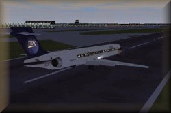
EOAC MD-90-30 landing at 27R at Heathrow airport
![]()
Coordinates: 51° 28' 16.00" N 0° 27' 11.00"
W
Elevation: 80 ft
ATIS: 123.9
|
Runway:
27L |
Glideslope:
1700ft @ 5NM |
|
|
Approach Course:
274deg |
Altitude/Surface:
78ft/Asphalt |
Length/Width:
11978ft/148ft |
|
Runway:
27R |
Glideslope:
1700ft @ 5NM |
|
|
Approach Course:
274deg |
Altitude/Surface:
78ft/Concrete |
Length/Width:
12776ft/148ft |
|
Runway:
09R |
Glideslope:
1700ft @ 5NM |
|
|
Approach Course:
94deg |
Altitude/Surface:
78ft/Asphalt |
Length/Width:
11978ft/148ft |
|
Runway:
9L |
Glideslope:
1700ft @ 5NM |
|
|
Approach Course:
94deg |
Altitude/Surface:
78ft/Concrete |
Length/Width:
12776ft/148ft |
|
Runway:
5 |
ILS:
NA |
Glideslope:
NA |
|
Approach Course:
47deg |
Altitude/Surface:
78ft/Asphalt |
Length/Width:
6455ft/148ft |
|
Runway:
23 |
ILS:
NA |
Glideslope:
NA |
|
Approach Course:
227deg |
Altitude/Surface:
78ft/Asphalt |
Length/Width:
6455ft/148ft |
|
EOAC endorses SATUK HEATHROW EGLL Information as official procedures for all services from and to London Heathrow Hub. EOAC aims to facilitate all necessary support to pilots in their research and relations with local SATCO divisions; if you have any questions or concerns with SATUK or SATCO in general, please send us a qestion.
|
![]()
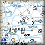
IFR Charts
London
Heathrow Charts
|
|
|
Procedures:
|
Departures:
SIDs |
Arrivals:
Standard routes |
Charts & procedures provided by SATUK.ORG
![]()
![]()
|
No freeware recommendations at the moment. |
![]()
